News
In spite of the science, NOAA’s site indicates one foot of sea level rise by 2050.
U.S. coastline to see up to a foot of sea level rise by 2050 National Oceanographic and Atmospheric Administration, February 2022
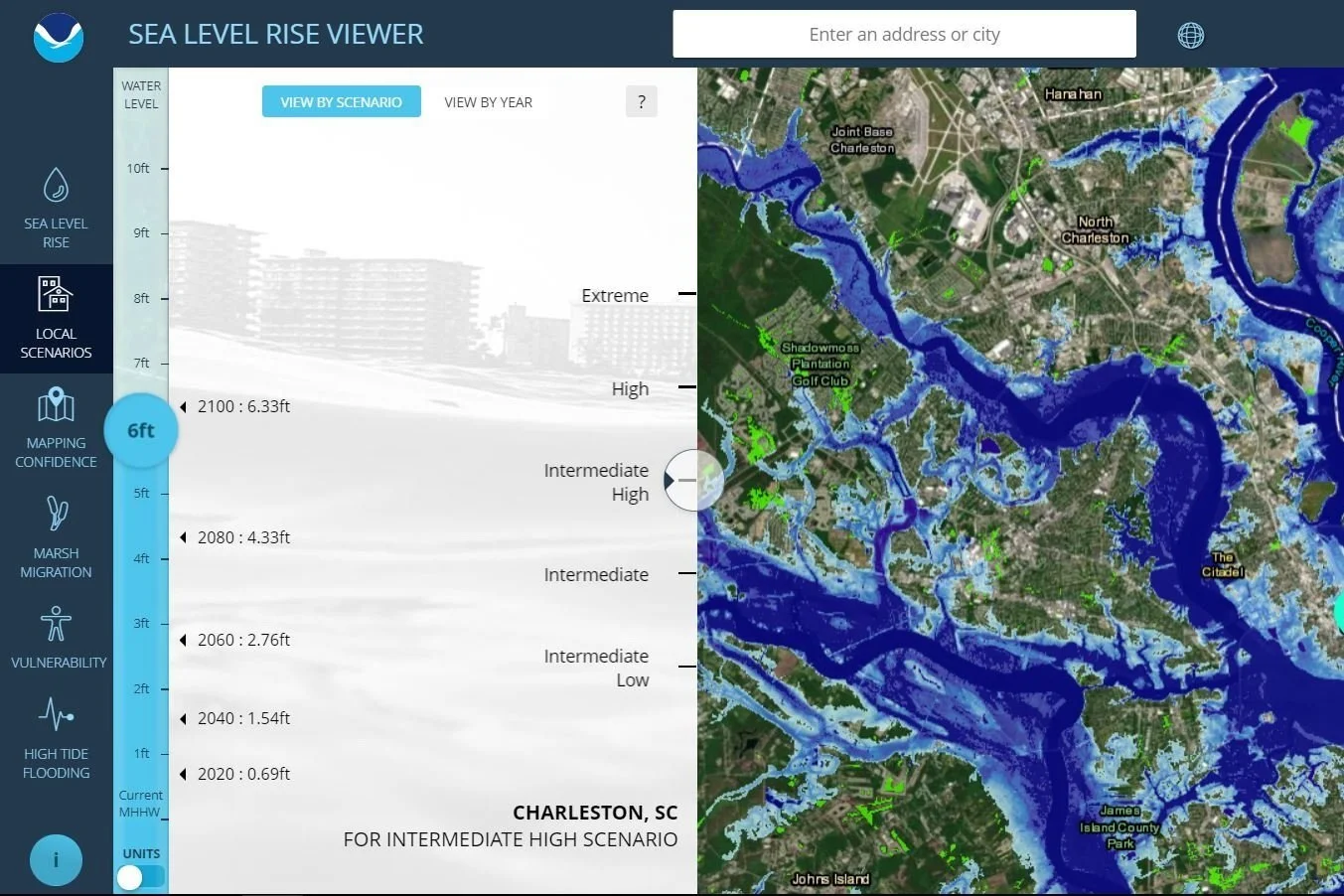
What will 10 foot of sea rise mean for your community? Use this tool to find out.
Seal Level Rise Viewer, NOAA
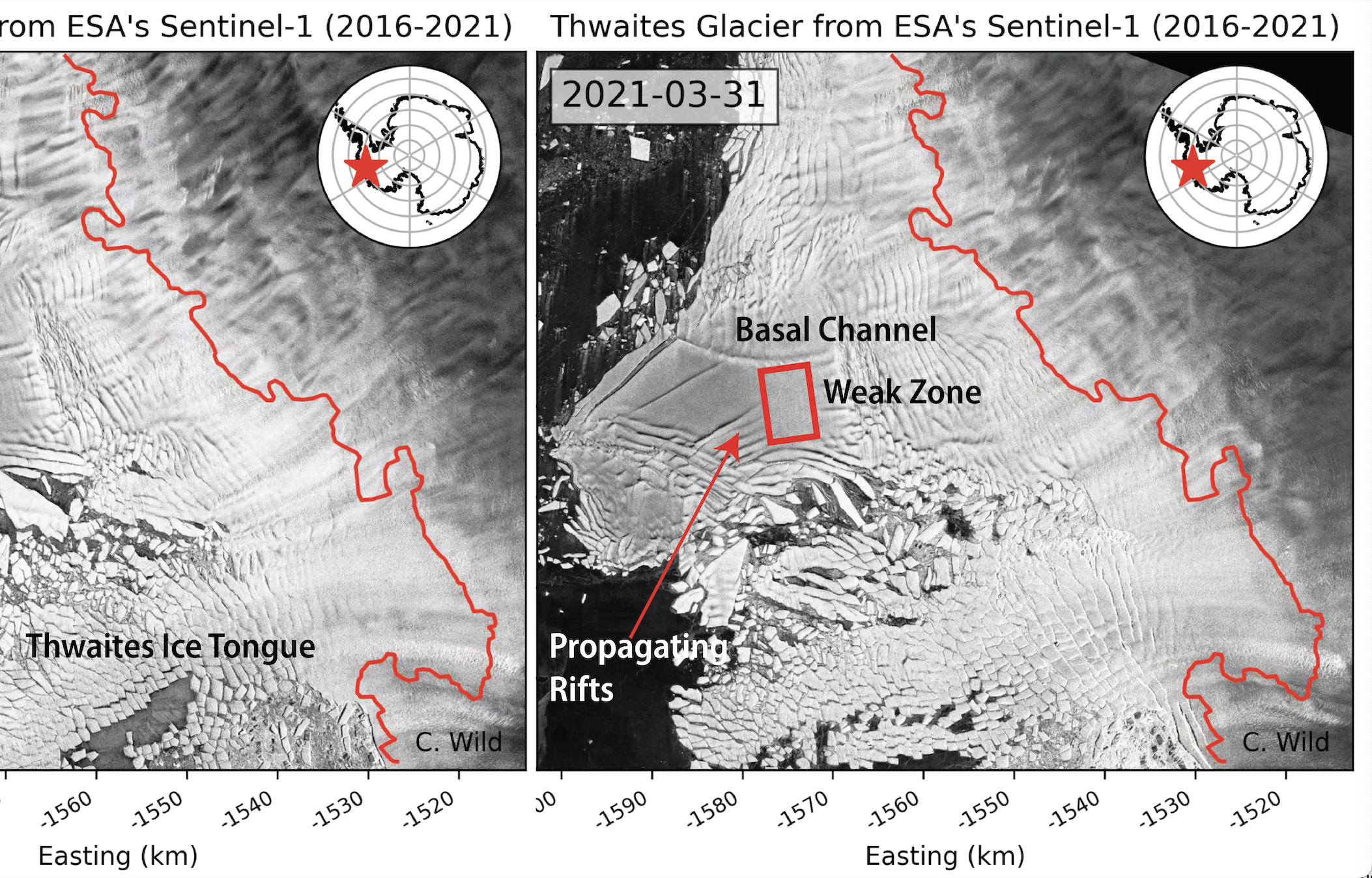
Weakening of the pinning point buttressing Thwaites Glacier, West Antarctica Christian T. Wild et al. Feb 3, 2022
This paper warns of weakening of the Thwaites pinning point within the decade.
An earlier version of the same paper warned of failure within 3 to 5 years.
Collapse of the Thwaites Eastern Ice Shelf by intersecting fractures Erin Pettit et al. Oregon State University, Dec 15, 2021
Mainstream science publications are starting to pick up the story.
Antarctica’s Collapse Could Begin Even Sooner Than Expected Scientific American, November 2022
Another example of mainstream press reporting on the threat, this time CBS.
Antarctica's "doomsday glacier" could raise global sea levels by 10 feet. Scientists say it's "holding on today by its fingernails." CBS News, September 2022
Photos
Homepage background image:
At around 120 km wide, Thwaites is the largest glacier on Earth and one of the most fragile glaciers in Antarctica. Imaged here by Copernicus Sentinel-2 on 26 November 2020, it’s hard to imagine what’s going on deep below the ice. Hidden from view by ice kilometres thick, there is a vast network of lakes and streams at the base of the Antarctic ice sheet. Using more than 10 years’ worth of altimetry data from ESA’s CryoSat satellite, scientists discovered that the lakes beneath Thwaites, the largest of which is over 40 km long, drained in quick succession, in 2013 and then in 2017. This kind of drainage under Thwaites has never before been recorded. Scientists estimate that the rate of drainage peaked at about 500 cubic metres a second – possibly the largest outflow of meltwater ever reported from subglacial lakes in this region. European Space Agency CC BY-SA 3.0
Mission background image:
Thwaites Tongue : The calving front of Thwaites Ice Shelf looking at the ice below the water's surface as seen from the NASA DC-8 on Oct. 16, 2012. Note how the water acts as a blue filter.
NASA's Operation IceBridge is an airborne science mission to study Earth's polar ice. For more information about IceBridge, visit: www.nasa.gov/icebridge
James Yungel, CC 2.0
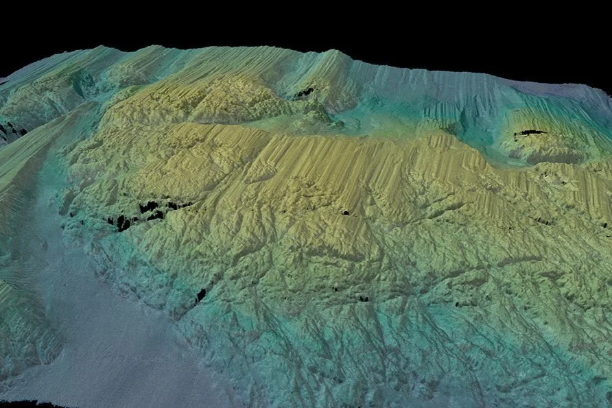
New imaging shows the glacier has had periods of even more rapid melt than what is happening today. This is alarming.
New seafloor images upend understanding of Thwaites Glacier retreat USF Marine Science, September 2022


